Link here to download extract from Planning Magazine January 2020 - How Planning Shaped Cambourne
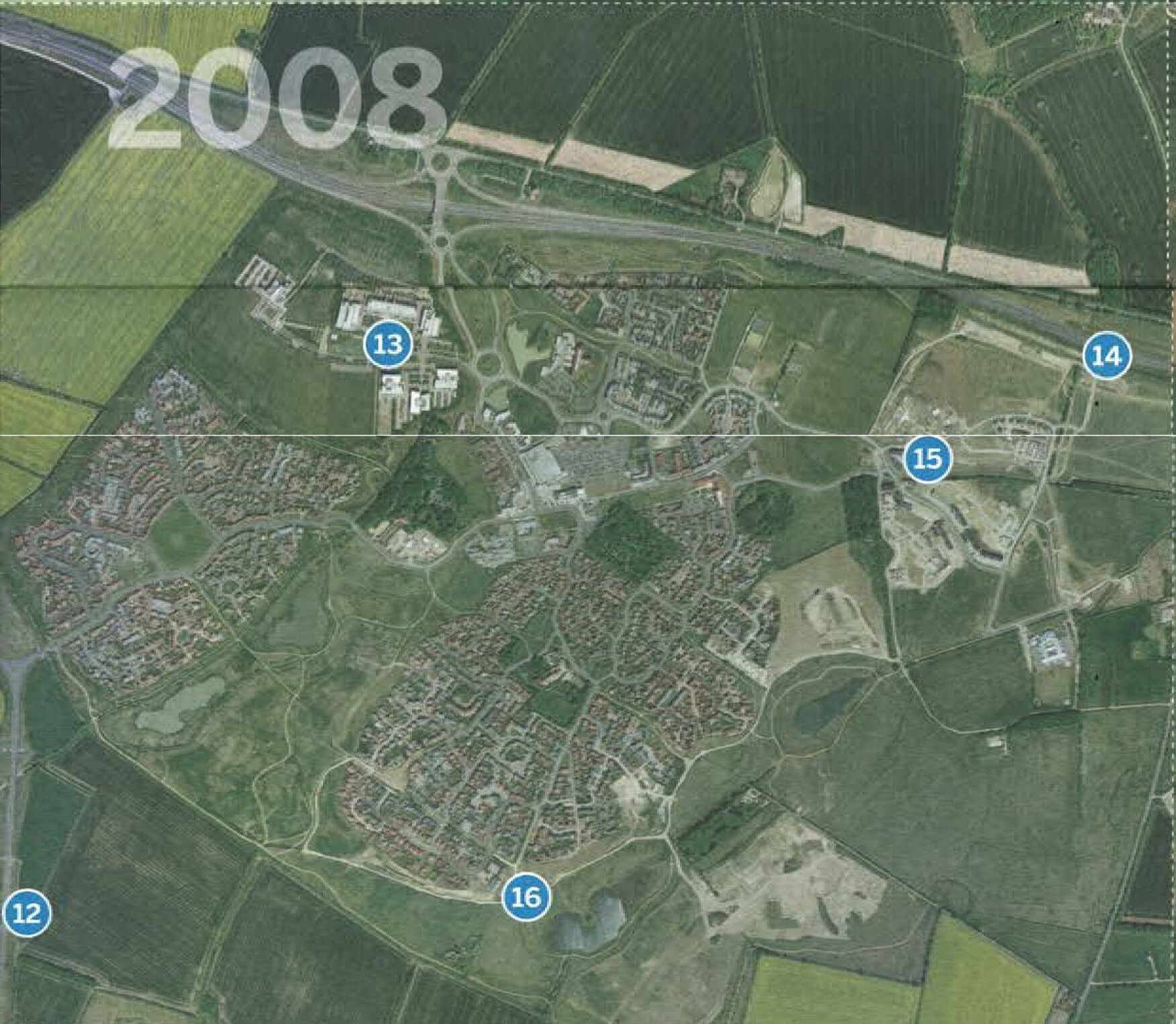
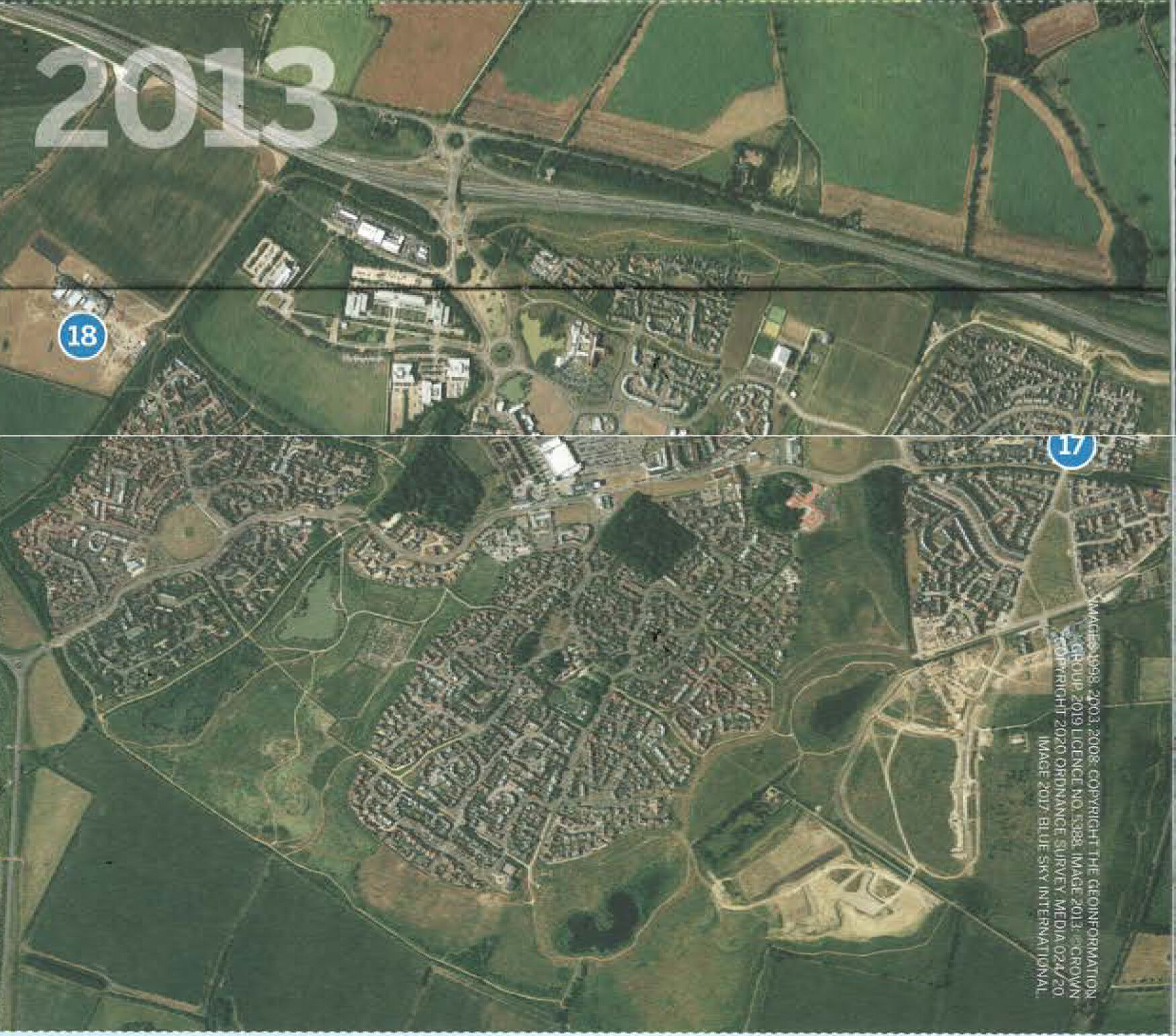
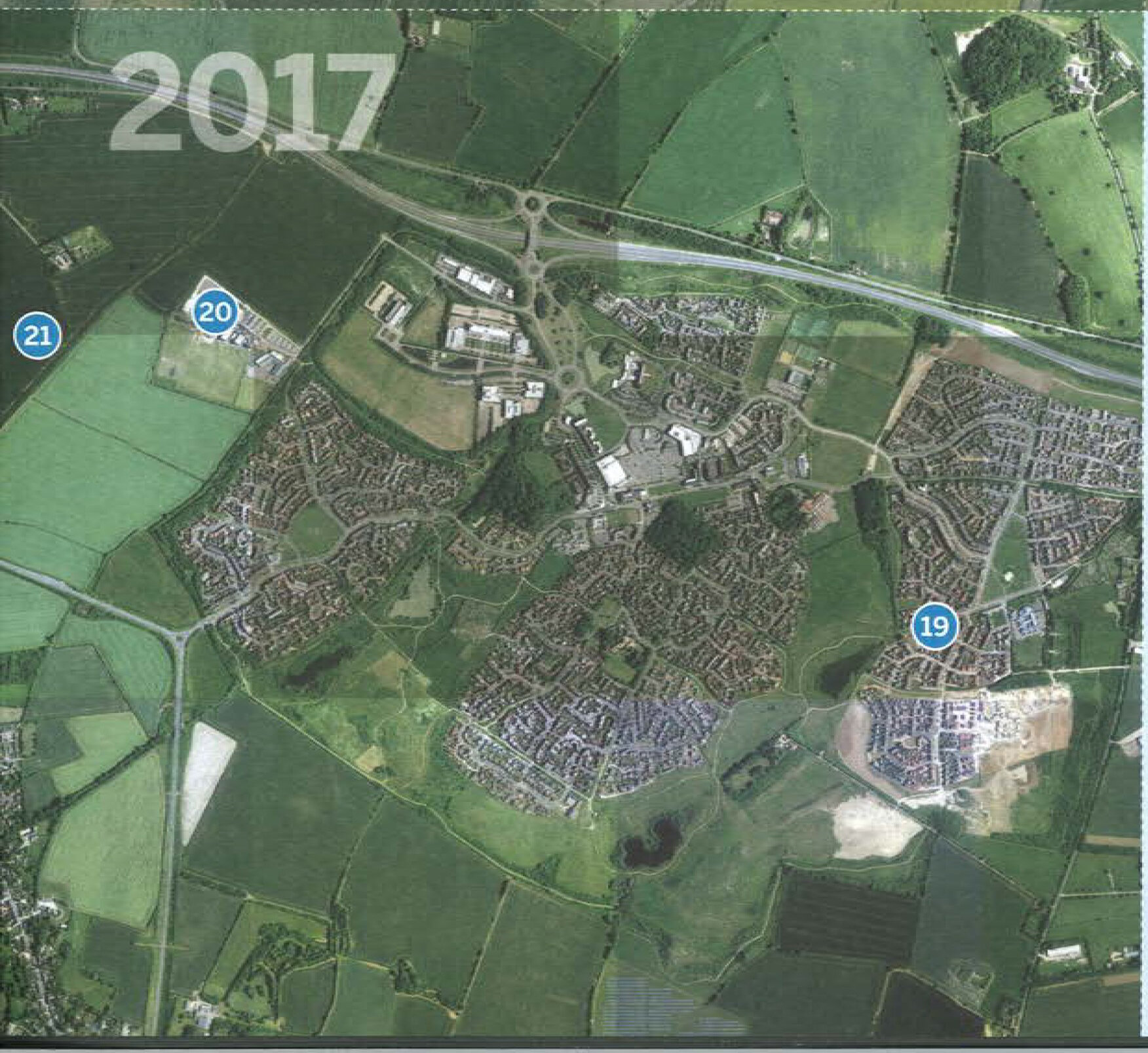
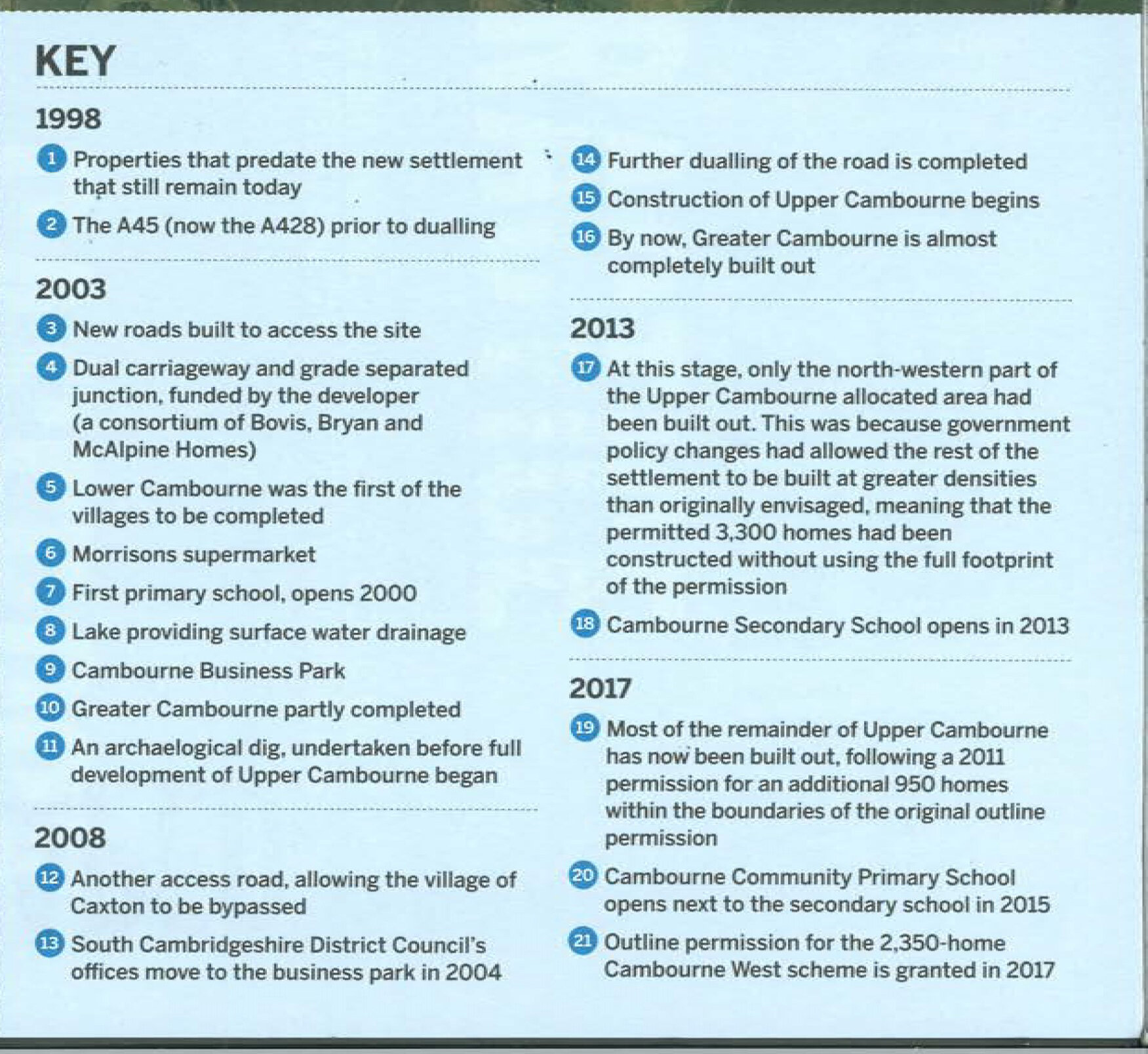
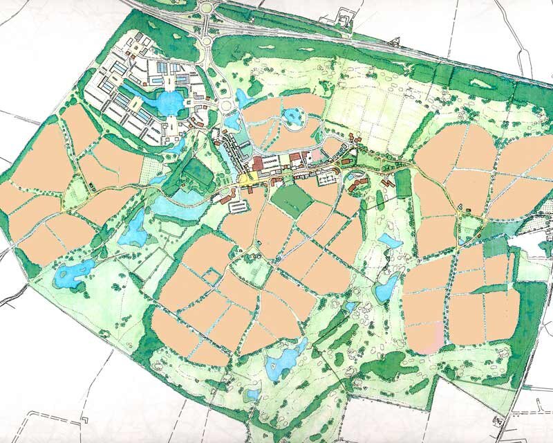
Gary Young with Farrells led the masterplan for Cambourne with initial designs in 1995 for a new town of 3300 homes on c 400 hectares of agricultural land located between St Neots and Cambridge on the A428, approved 1998 and subsequently increased to c 8000 homes.
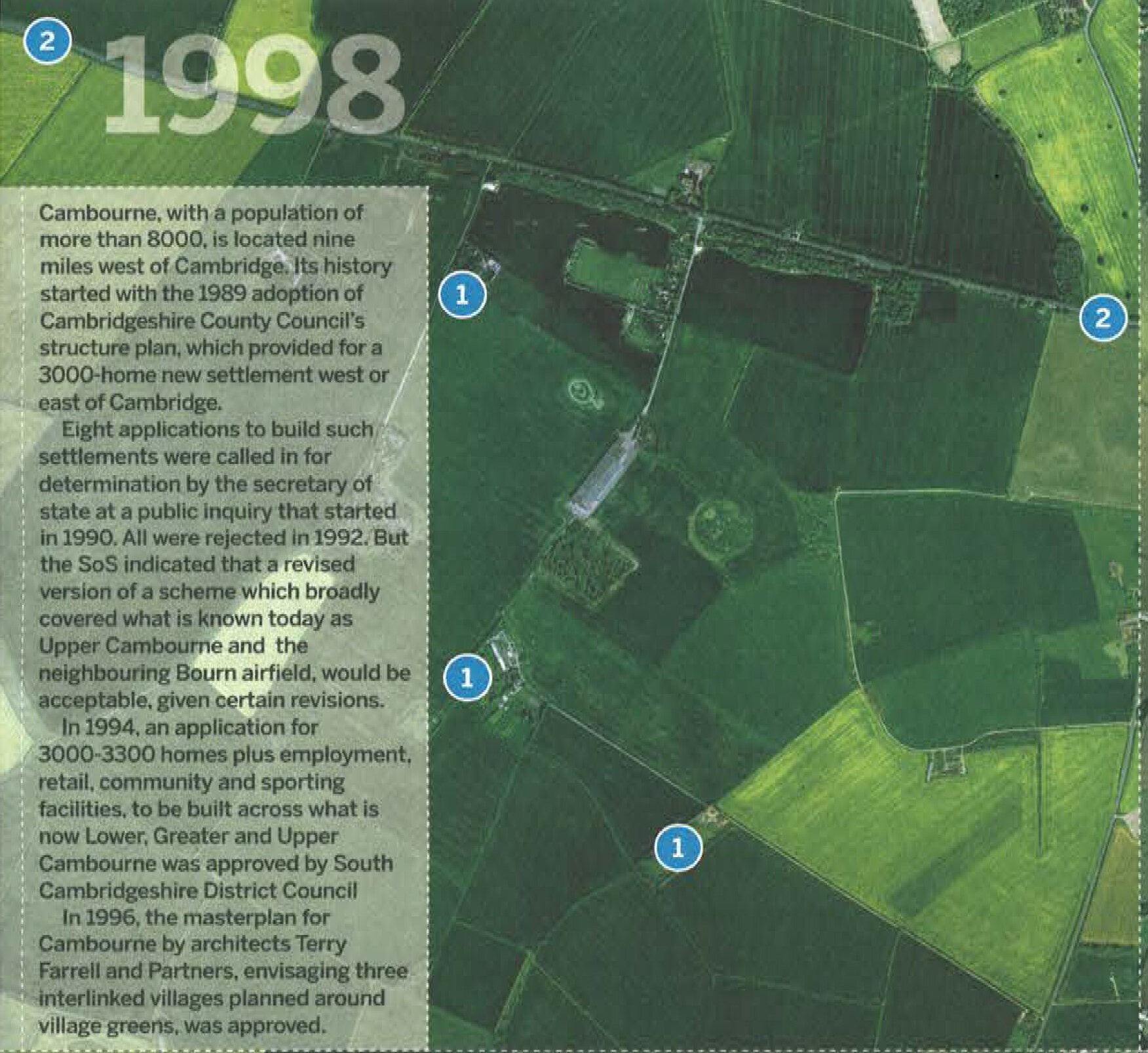
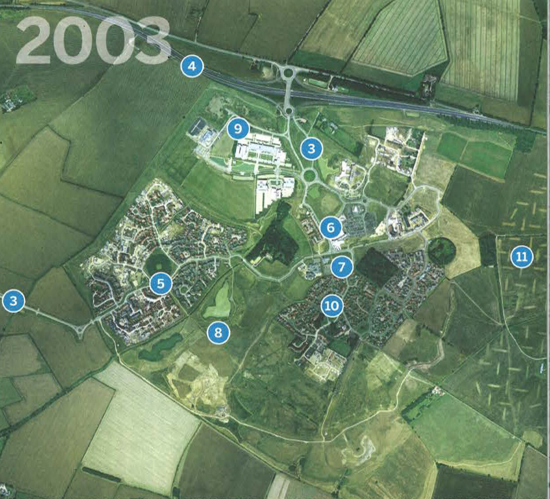
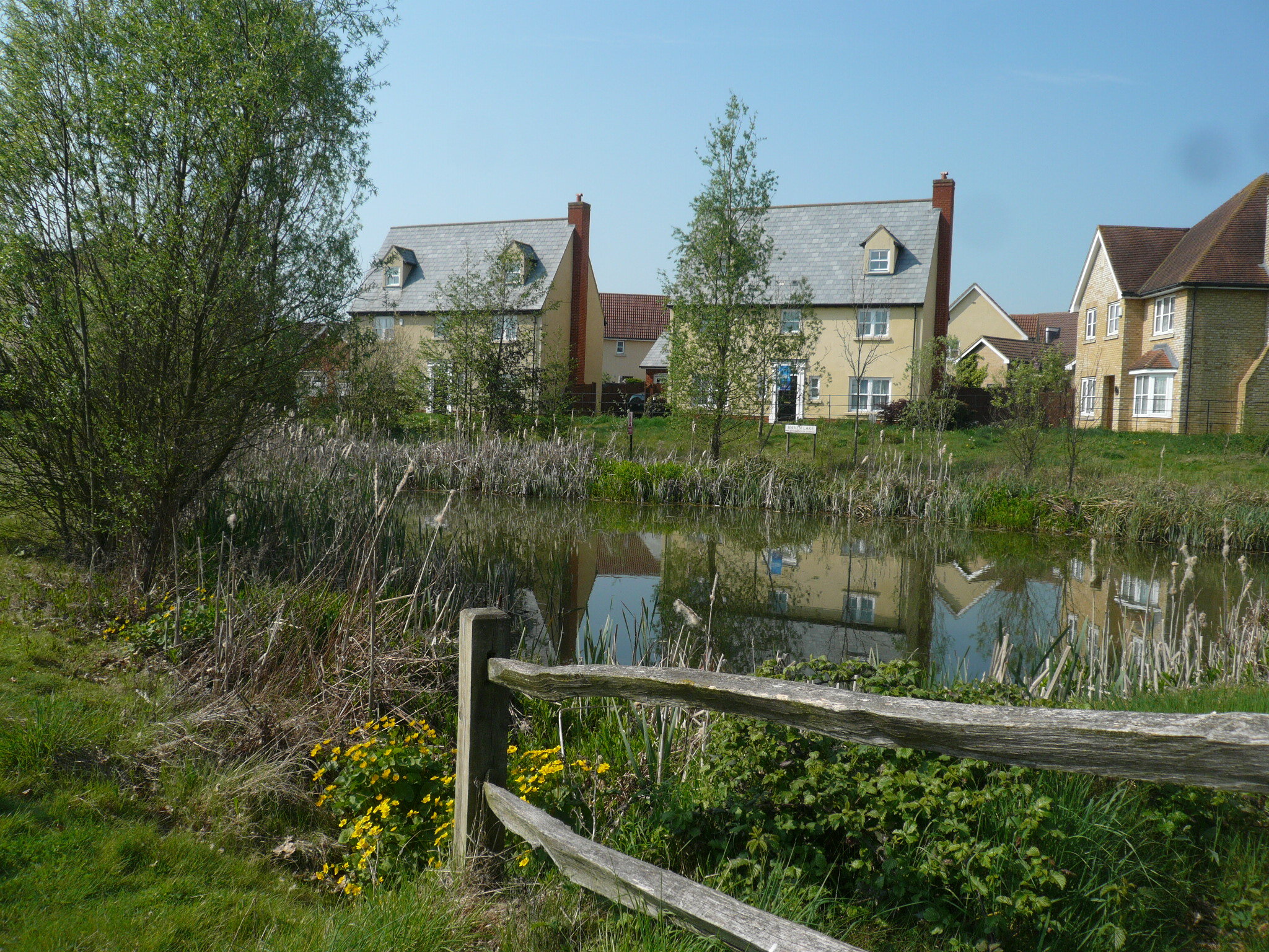
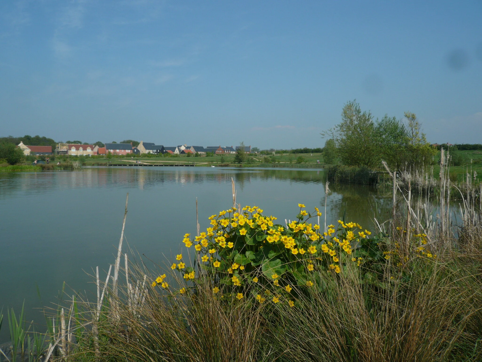
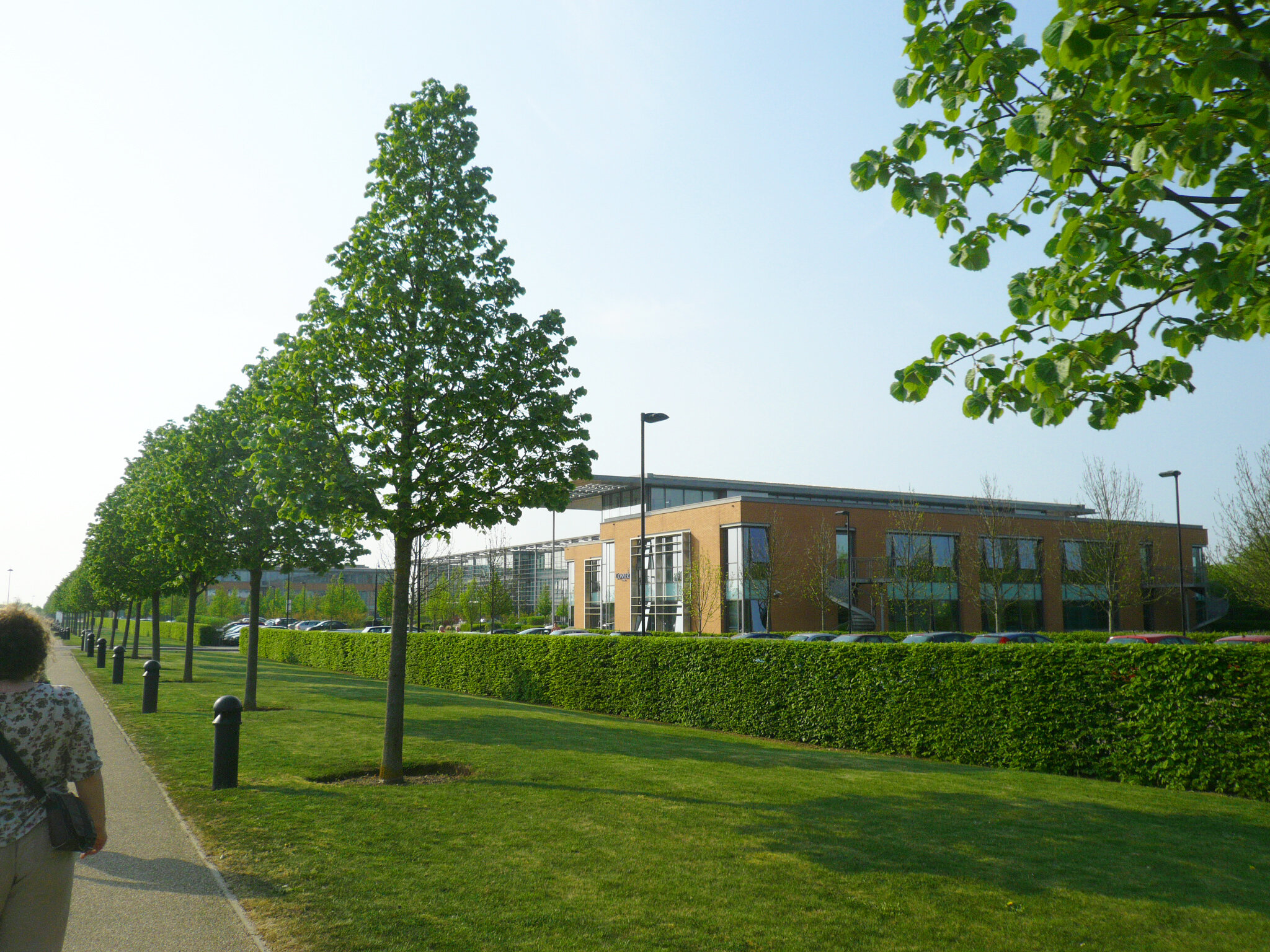
The masterplan concept was closely influenced by the existing landscape, with two streams running towards the south naturally creating three areas for development linked at the north with higher ground and the main roads. The masterplan concept of “three villages and a high street” weaves landscape and water through the housing with existing farm buildings and shelter tree planting key focal points for village greens and community buildings. The villages have rural edges to the south with the high street connecting the villages together to the north, providing mixed uses with regional public transport accessibility through bus routes along the A428 to Cambridge and St Neots.
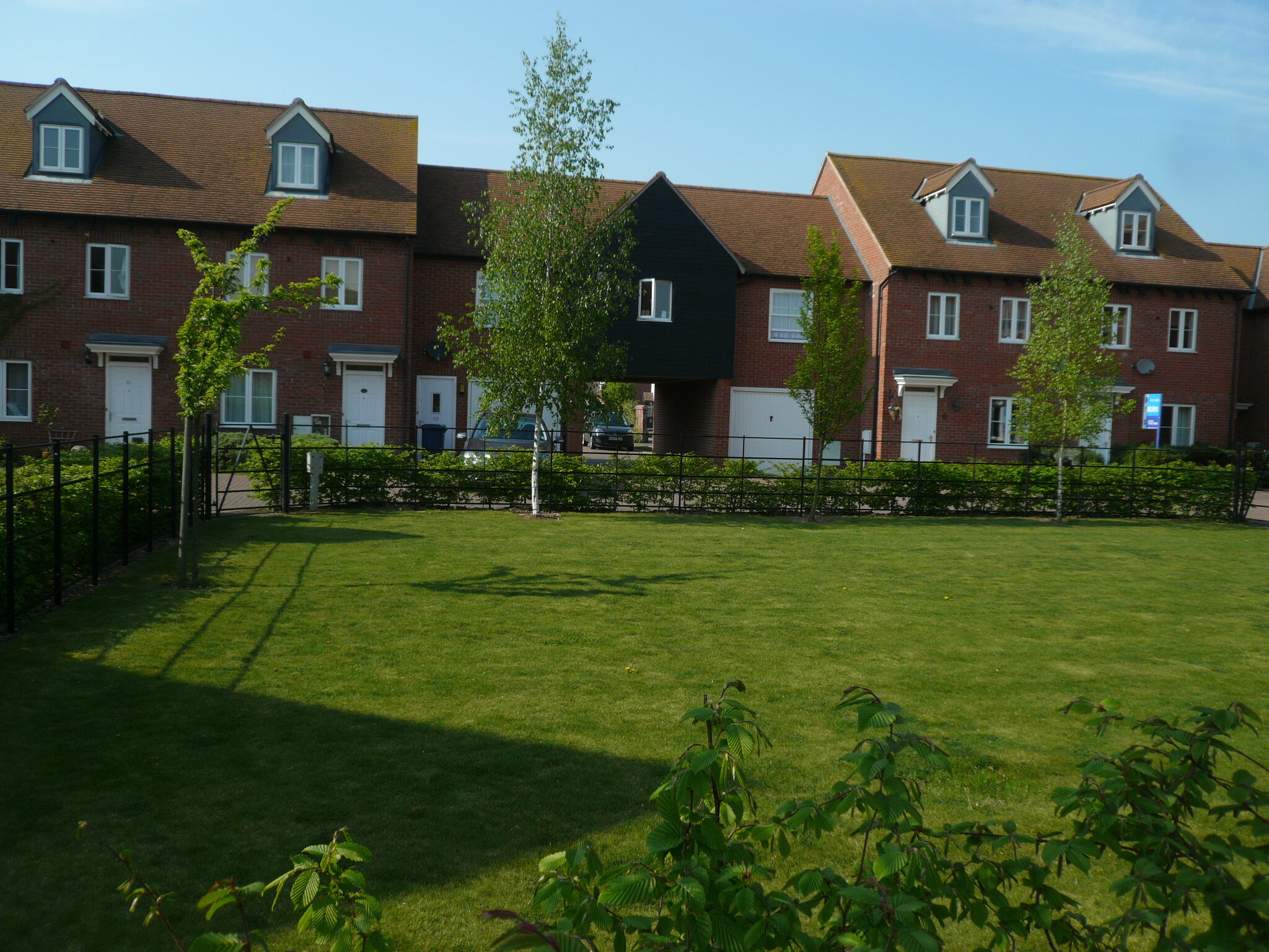
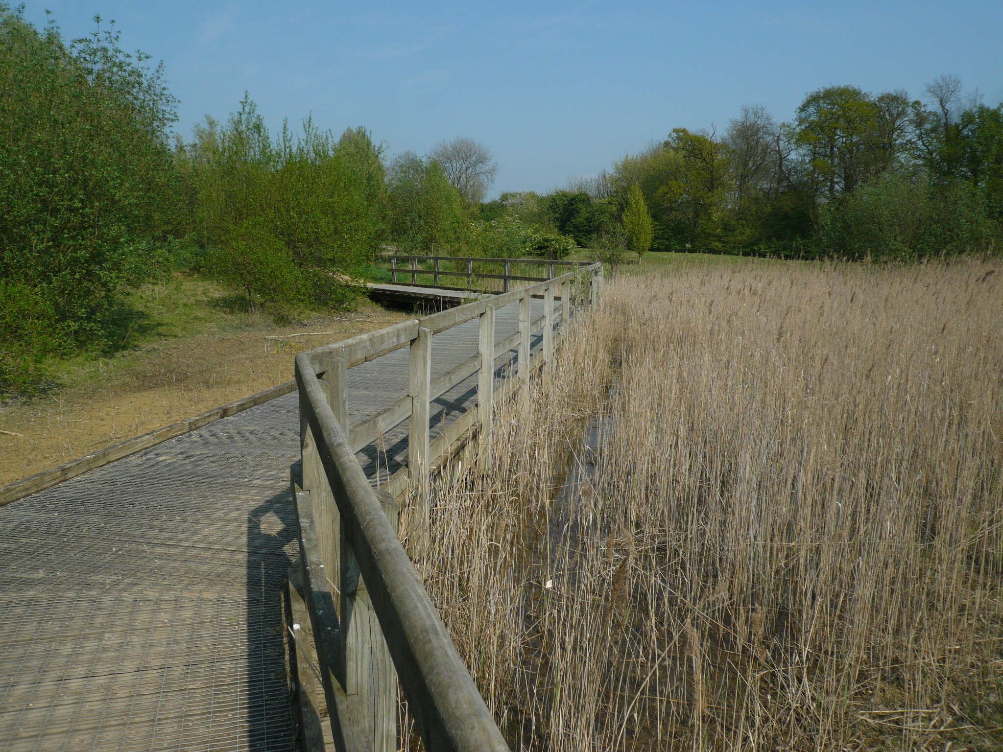
Outline planning application and design guides were completed and approved in 1998. The project, first occupied in 1999, has been completed by the Cambourne Consortium over 25 years.The project has won many landscape design awards, with 243ha open space comprising: 45ha woodlands, 23ha grasslands,6ha lakes and wetlands, 28 ha country park, 9ha eco park, 200,000 trees and shrubs, 10 miles of hedgerows and 12 miles of pathways.
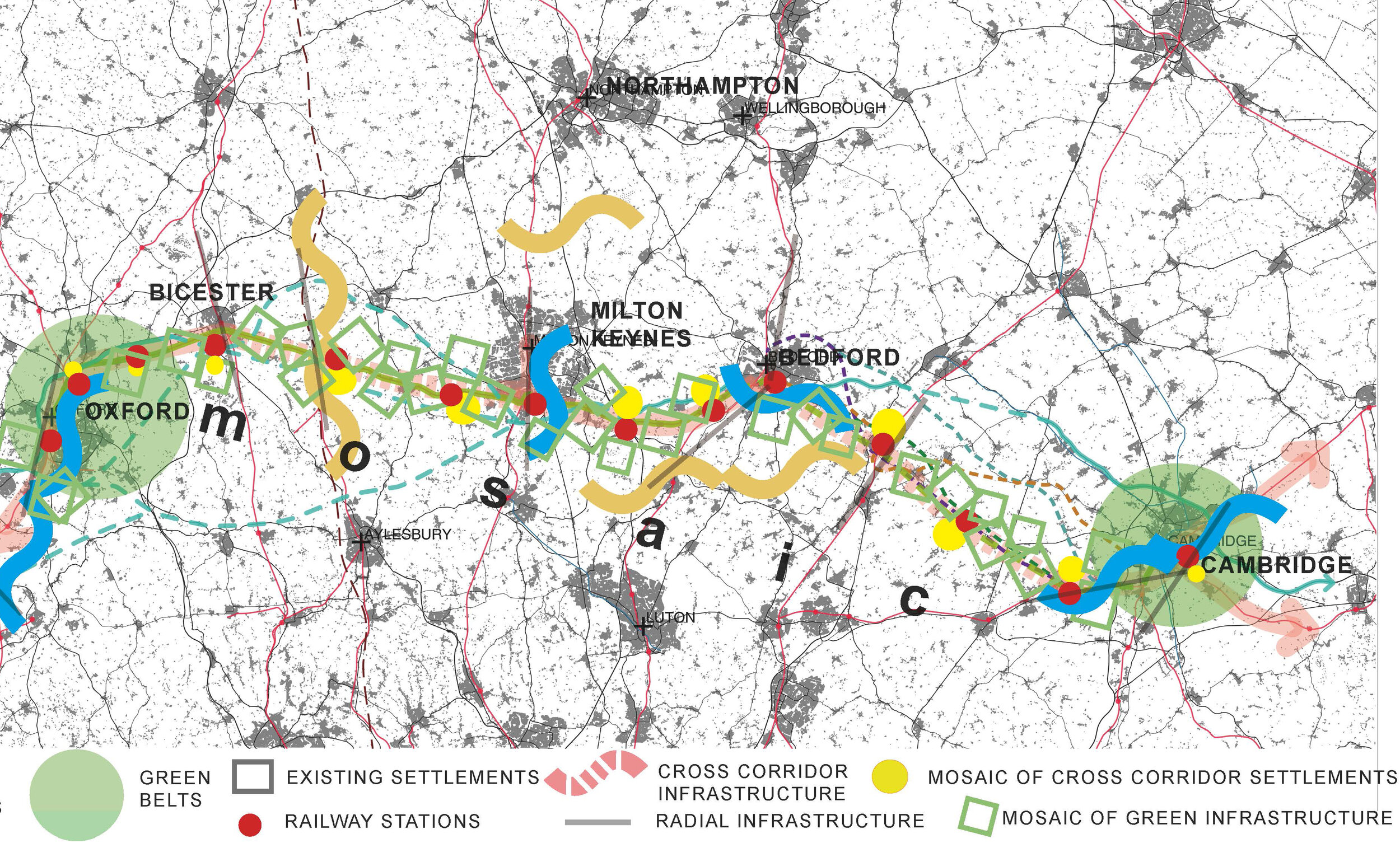
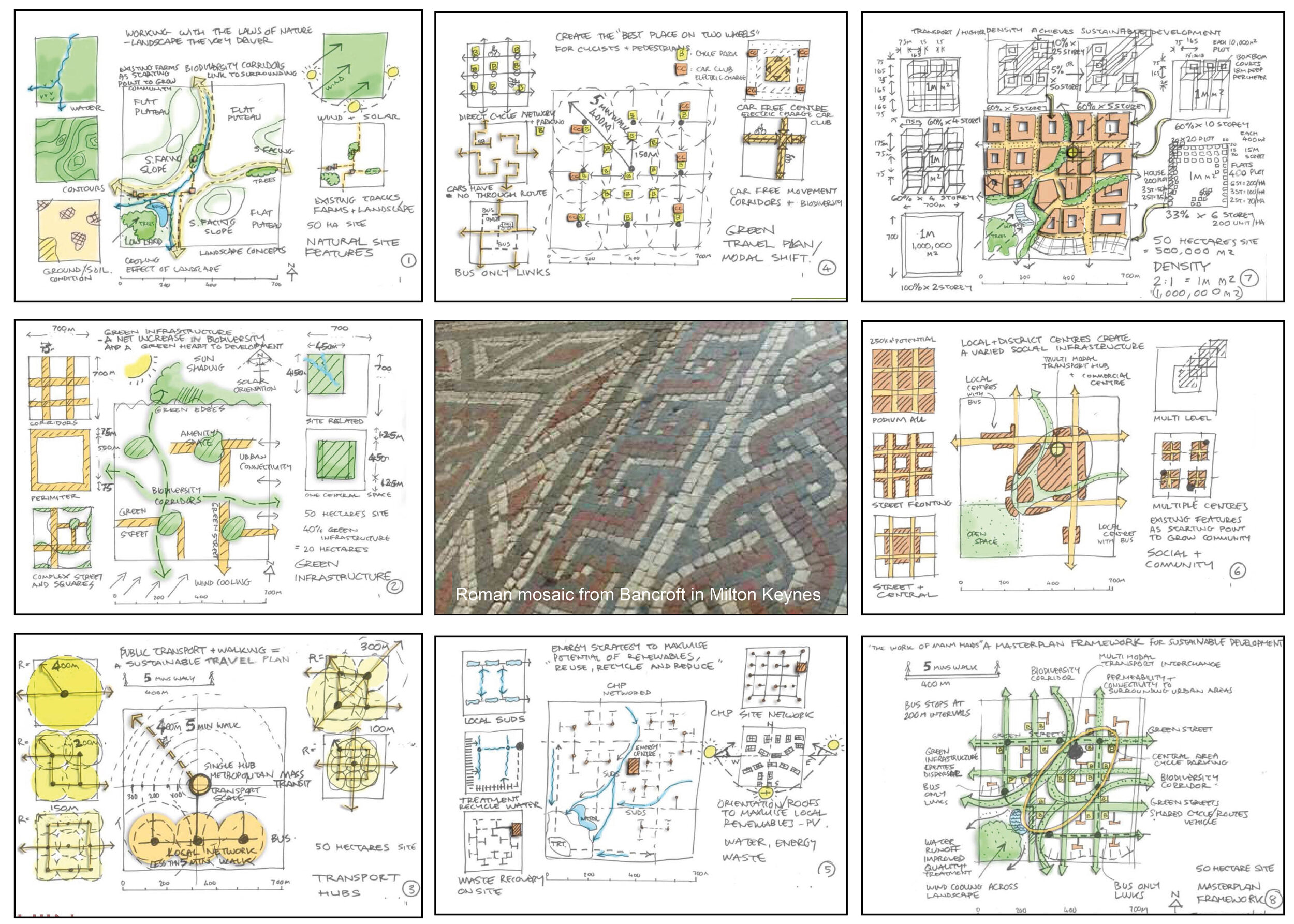
Cambourne is one part of a masterplan for Cambridge to Oxford Connection created by Gary Young and published in the National Infrastructure Commission exhibition July 2018 at Transport Catapult, Milton Keynes, UK. The landscape concept of a mosaic created from the existing patterns of rivers, flood plain, hills, woods, towns, villages and farms, is an environmental framework for establishing urban extensions and new autonomous garden towns and villages.
The mosaics create loose frameworks intensifying at transport hubs with development of housing, employment and social infrastructure, interweaved with a mosaic of landscape providing strong connectivity for biodiversity gain, healthy lifestyles and food production.
The masterplan considers opportunities for growth in employment and housing within a framework of autonomous settlements of various sizes located at rail transport intersections between Cambridge, Milton Keynes and Oxford. The Mosaic narrative derives from the remains of a Roman villa mosaic embedded within the commercial centre of the MIlton Keynes 20th century new town, providing a timeline of continuous change in an area of ancient routes, historic landscape and settlement patterns. The mosaic links together railway routes both existing radial and potential for cross connecting.
The masterplan links with the Market Garden City planning concept created by Gary Young and Hannah Smart, advocating sufficient land surrounding settlements to provide for local food production with dispersed local food share hubs, connecting social and natural infrastructure at the rural and urban scale.